Login
Search this album
Home
Gallery
4. Places
The Italian Ear…
A detailed map…
Previous
3 of 102
Next
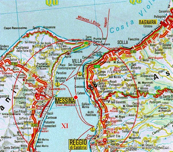
A detailed map of the Messina earthquake area.
A detailed map of the Messina earthquake area affected approximately at Level XI (Catastrophic) on the Mercalli Scale.
Comments
No comments yet.
View full size
View comments on this item
Photo info
Title:
A detailed map of the Messina earthquake area.
Description:
A detailed map of the Messina earthquake area affected approximately at Level XI (Catastrophic) on the Mercalli Scale.
File name:
aaa-01.jpg
Owner:
Gallery Administrator
Dimensions:
604 x 533 px
Available RSS feeds
All new comments
Comments on A detailed map of the Messina earthquake area.
Latest photos and movies
The Italian Earthquake photos and movies
Popular tags
1 photos are tagged with
#Canada
1 photos are tagged with
#Yard 300
1 photos are tagged with
Atocha
1 photos are tagged with
battleship
1 photos are tagged with
Canopic
1 photos are tagged with
Coast Guard
1 photos are tagged with
Document
1 photos are tagged with
dreadnought
1 photos are tagged with
Itinerary USS Connecticut
1 photos are tagged with
provisions
2 photos are tagged with
Rumor